
As part of the Masters of Environmental Science Co-op program, this summer I was hired by Sikumiut Environmental Management Ltd. (SEM) to complete my work term. SEM is the largest wholly Newfoundland and Labrador owned and operated environmental consulting firm in the province. It is registered as an Inuit Business with the Nunatsiavut Government and is considered as an Aboriginal Business under Federal Government criteria.
My position at SEM involves geomatics work through surveying and GIS, environmental assessment and monitoring and some work with unmanned aerial vehicles (UAVs). I am currently about half way through my work term and I will be heading back to school in the fall to finish my last semester of my Masters program.
Some of my most interesting work with SEM has been with UAVs. Through this position I have had the opportunity to act as both an airspace observer and a pilot for UAV flights. During my time so far I have worked with two UAVs: the senseFly eBee and the DJI Phantom 2.
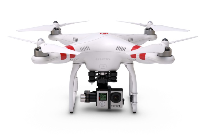
The DJI Phantom 2
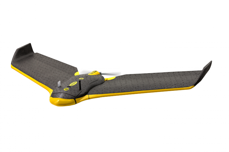
The senseFly eBee
The eBee is a fixed wing UAV equipped with RTK which is used to enhance the precision of position data derived from satellite-based positioning systems. It is mainly used to take aerial photographs and derive 3D models from the resulting photos through photogrammetry. The eBee is a completely autonomous system which will carry out the planned flight path automatically after it is launched. The Phantom is a quadcopter which is equipped with a GoPro camera for capturing high resolution video. The Phantom can operate both manually as well as autonomously. Both the eBee and the Phantom are less than 2kg in weight and fall under Transport Canada’s < 2kg exemption.
A SFOC is an application for permission from Transport Canada to allow an operator to adjust/change specific criteria within the exemption. (e.g., flying at a maximum altitude of 500ft rather than the maximum of 300ft as listed under the exemption.)
Most of what I have learned from this position comes from the field work I have completed. Already this summer I have completed two trips to Labrador and I am scheduled for a couple more before the summer ends. My first trip was in mid-April for two days. This trip involved the installation of a staff gauge and barometric pressure sensor at two locations in the Lab City-Wabush area. Most recently I have just finished a nine day trip to Labrador/Quebec. The first week was spent in the Lab City-Wabush area where I worked on various tasks including: UAV surveying, tree planting, installation of water temperature sensors, public consultations, surveying streams and its embankments, water sampling, and determining water level/flow for the purpose of creating a baseline stream profiles. The last two days of the trip were spent near Schefferville, Quebec which involved collecting water samples and flow measurements from a fish offset stream which was created by SEM in previous years.

Top left: Aerial view showing an incredible contrast between the now abandoned iron ore mine and the surrounding forest, near Schefferville, Quebec. Top right: Arriving at the Schefferville Airport. Bottom left: Not Sasquatch, just a big black bear. Bottom right: Sign with translations to local aboriginal languages.
So far my work term as been great! Everything I have learned during my brief time at SEM has complimented my course work from the Master of Environmental Science program very nicely. It has been a great opportunity for my development both personally and professionally.

On top of Smokey Mountain, overlooking Labrador City-Wabush, NL.


